


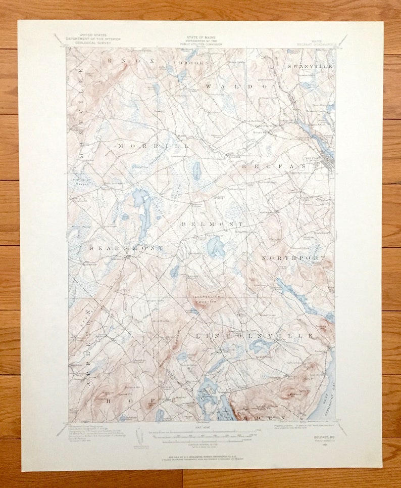

Sold Antique Belfast, Maine 1915 US Geological Survey Topographic Map – Northport, Lincolnville, Swanville, Hope, Appleton, Waldo, Penobscot Bay
Beautiful, antique map of Belfast, Maine and surrounding Waldo County and Knox County area. This is an authentic 1915 edition, 1962 print from the U.S. Geological Survey and NOT a computer reproduction.
See what Maine looked like over 100 years ago. Lots of intricate details and geological contours. Map even has little squares for every house that existed at the time. The USGS cartographers were very thorough back then!
Perfect for the historian, map-lover, the curious or just as a conversation starter. Wonderful and rare. Vintage maps such as these make great gifts.
Edition of 1915, printed 1962
Dimensions: 17" width x 21" height
----
Features
Cities & Towns: Montville, Knox, Brooks, Morrill, Waldo, Swanville, Searsmont, Belmont, Belfast, Appleton, Northpoint, Hope, Lincolnville, Camden, Allens Hall, Poors Mill, Yorks Corner, Shermans Corner, City Point, Head of the Tide, North Searsmont, West Searsmont, Center Belmont, Dog Island Corner, Slab City, Ducktrap, Youngtown, Grants Turn.
Points of Interest: Passagassawakeag River, Penobscot Bay, Waldo County, Knox County, Megunticook Lake, sold Quantabacook Pond, Tildens Pond, Pilcher Pond, St. George River, Knight Pond, Coleman Pond, Upper Mason Pond, Appleton Ridge, Levenseller Mountain, Frye Mountain, Philbrick Mountain, Moody Mountain, Muzzy Ridge, Patterson Hill, Ruffinghart Meadow, Witcher Swmap and many more streams, ponds, marshes, villages, houses, roads, railroads and mountains.
Condition: Very Good condition, commensurate with age. This map is in incredible shape for being almost 60 years old.
----
We will happily adjust shipping price for multiple purchases. Maps are rolled up and shipped in sturdy mailing tubes, never folded.